Geospatial Software for Faster, Better Decisions
Our geospatial SDK for visualization and analysis is designed to be fully integrated into customers’ applications and can also serve as the core of any geospatial web service environment. Our commitment to open standards ensures that most data formats can be read and implemented, eliminating the need for conversions.
Products
Carmenta Server
Carmenta UAS Mission Kit
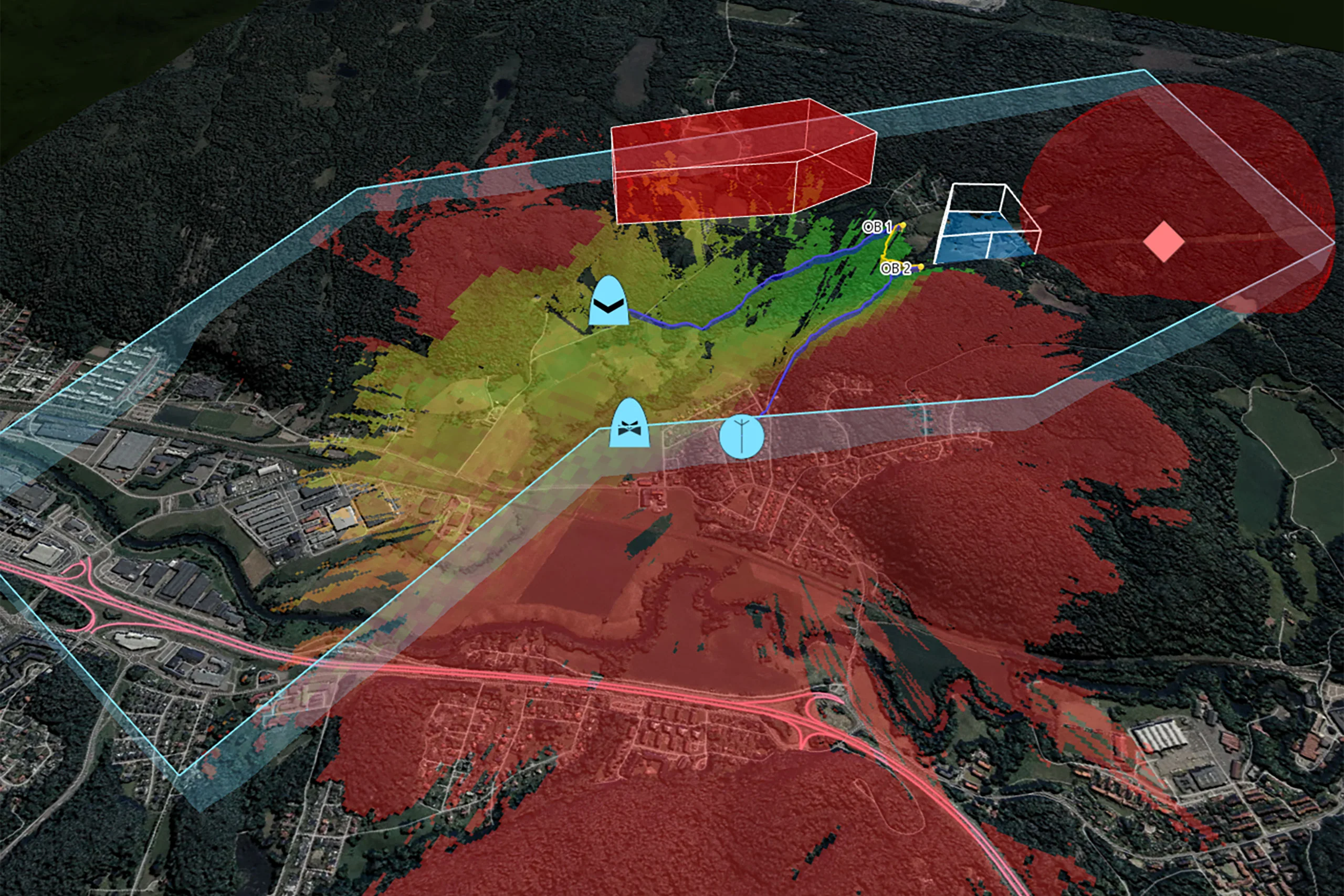
Carmenta UAS Services

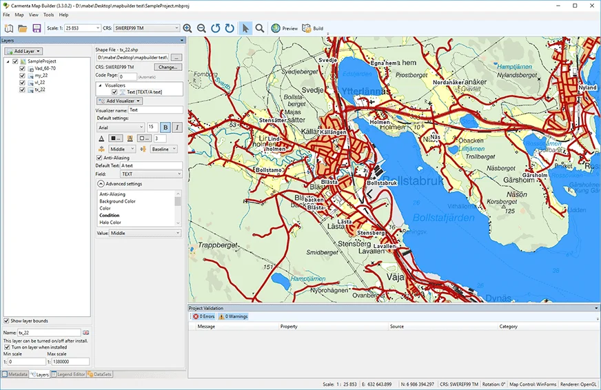
Carmenta Map Builder
Try for free – no commitment
Are you ready to see how our products can transform your work? Request a free trial today and explore the full potential of our geospatial technology.
Our free product evaluation includes:
- 30 days unlimited access to our SDK.
- Full access to our e-mail support during the evaluation period.
- Full access to our online self-study course during the evaluation period.
Please specify which product/products you are interested in.
This form can be used to request a trial for:
- Carmenta Engine
- Carmenta Server
- Carmenta Map Builder