
Access to prevailing and forecast weather conditions is crucial in many decision-making situations. Modern weather forecasting is based on sophisticated weather model calculations, involving vast amounts of predicted meteorological information for specific locations and altitudes. High-quality meteorological data from the world’s leading weather forecast providers improves situational awareness for operators in a wide range of applications.
Carmenta Weather Modules enable easy integration of this type of data and weather forecast maps can be added to any Carmenta-based system. The modules can also be linked to commercial providers, such as C-MAP Weather Services.
A valuable resource in any industry
Carmenta Weather Modules are highly useful across a range of use cases, including:
- Military Command & Control (C2), where all command levels can benefit from automated weather forecasts to aid decisions when making deployment plans and running military operations.
- Maritime Fleet Management, where the use of shipping lanes and waterways can be restricted significantly due to wind direction, height and precipitation.
- Aviation Route Planning, where flight plans are particularly sensitive to the weather conditions. On a day-to-day basis, flights are routed to avoid severe weather conditions and take advantage of jet stream tailwinds to improve fuel efficiency. In these conditions, accurate three-dimensional weather forecasting is essential.
- Public Safety Operations, where making the right decision at the right time can mitigate the effects of severe weather conditions and aid rescue operations. Potentially hazardous weather conditions, such as strong winds, extreme temperatures and heavy rain or snowfall, can have a major impact on public safety, and access to early warning systems makes it easier to be prepared.
- Intelligent Transportation Systems (ITS), where knowledge of anticipated weather conditions facilitates efficient planning and traffic control, reduces fuel consumption, and improves the overall efficiency of the traffic system.
Tech specs
- Features Support for reading GRIB (GRIdded Binary) format data, v. 1 and 2. Scheduled and automatic downloads of data can be set up via different configurable channels.
- Support for downloading C-MAP meteorological data with automatic updates.
- Downloads and prepares the meteorological data offline, automatically converting and caching the raw gridded data as point, line and area features. The features are cached for various time intervals, periodicity and altitudes. An API enables users to adjust the download settings. A separate module creates rendered map layers from the cached feature data. This module can be easily integrated with any new or existing Carmenta Engine-based application or Carmenta Server web map site. The module also has an API to query weather values for specific positions, altitudes and dates/times.
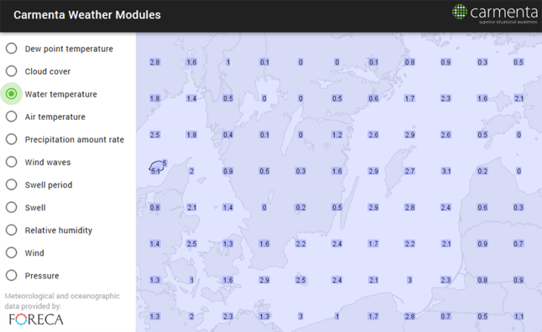
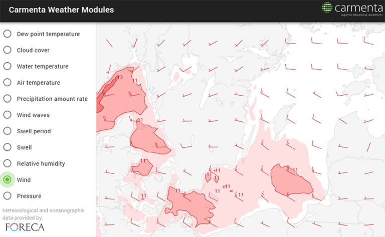
- The product comes with ready-to-use map layers with a carefully selected cartographic layout. A wide range of weather parameters can be visualised as grid points (as texts or symbols), isolines and semitransparent areas – either separately or in combination. Due to the multi-dimensional nature of meteorological data, it is possible to show forecasts as map layers that represent different atmospheric height layers depending on the use case.
- The modularity of the product enables a very flexible set-up. The modules can run on a single machine but can also run separately in a distributed solution. A typical use case is to run the download module on a separate HW in order to isolate the downloading aspect from the actual application.
- When running the product integrated with Carmenta Server, all meteorological layers are automatically published as images through OGC WMS and/or as features through OGC WFS. The product also supports the OGC standardised “Time” and “Elevation” parameters.
Request a trial
Interested in learning more about Carmenta Weather Modules? Or ready to get started? Fill in the form below. One of our team members will get in touch with you.